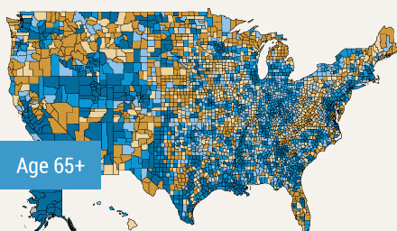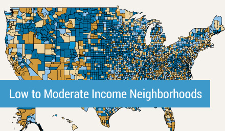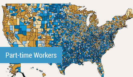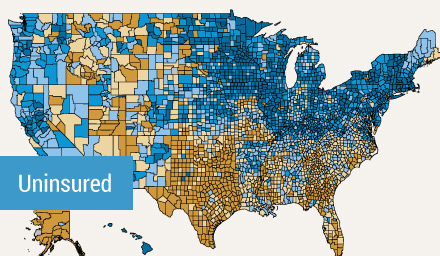


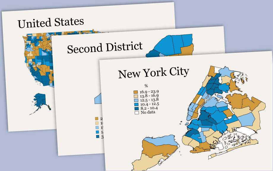
The spread of COVID-19 is profoundly affecting communities across the country. Information about the populations that are at greatest health and economic risk, both in the near- and longer-term, is essential as local policymakers, nonprofits, and other stakeholders aim to mitigate the effects of the disease. The maps on this page help to locate the communities that are most vulnerable to COVID-19 across the nation, in the Federal Reserve’s Second District, and in New York City.
Specifically, the maps examine the 94 million Americans living in neighborhoods with lower income levels, as well as the more than 50 million Americans ages 65 years and older. The maps also include detailed information about the places with higher shares of part-time employees as a barometer of the likelihood of having to file for unemployment, given that these workers are not salaried. Finally, we map the communities where fewer individuals have health insurance. All data are from the U.S. Census 2014-2018 5-Year American Community Survey.